
Rain chances, “cooler” temps possible early next week
FORECAST HIGHLIGHTS
-
RECORD HEAT: Near 100°, heat advisories in place
-
STEADILY HOT: Temps come down *some* but still hot this week
-
A CHANGE?: We are cautiously optimistic for rain and cooler (really, not-as-hot) weather by early next week
FORECAST
RECORD HEAT
The last full week of summer is showing out. We hit 100° today, beating a record, and likely will be right back in the same position for the rest of the week. Heat indices will reach the 100-103° range. Heat advisories have been posted along and east of I-35.
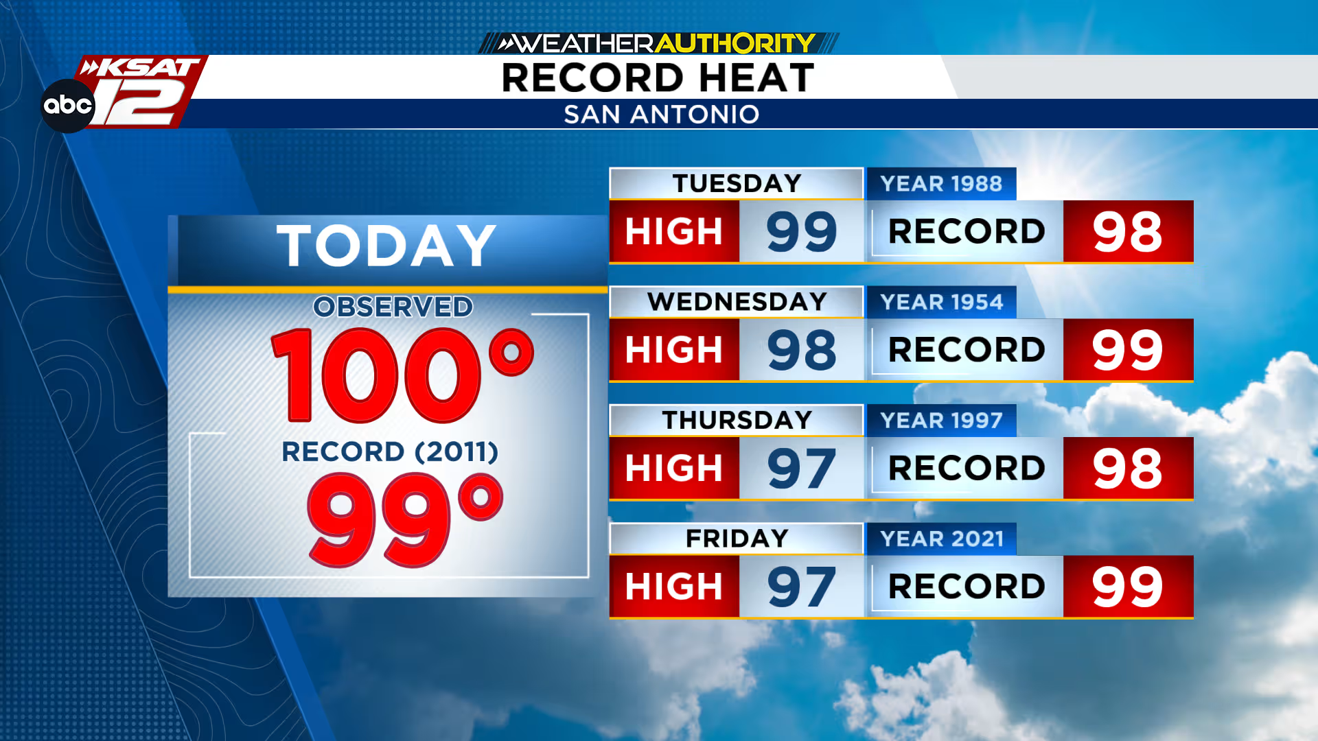
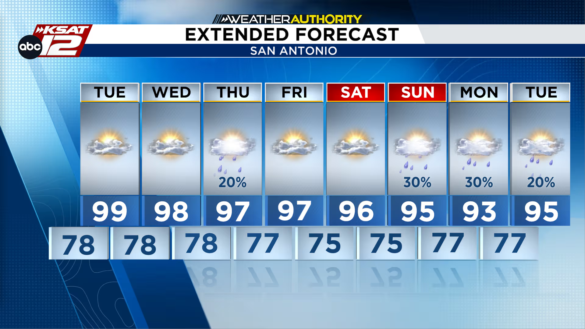
STEADILY HOT THIS WEEK
Temps will come down some this week, but not by much. Above average heat will be the norm. We’ll watch for another small shot at showers or storms on Thursday, however, rain chances sit at only 20%.
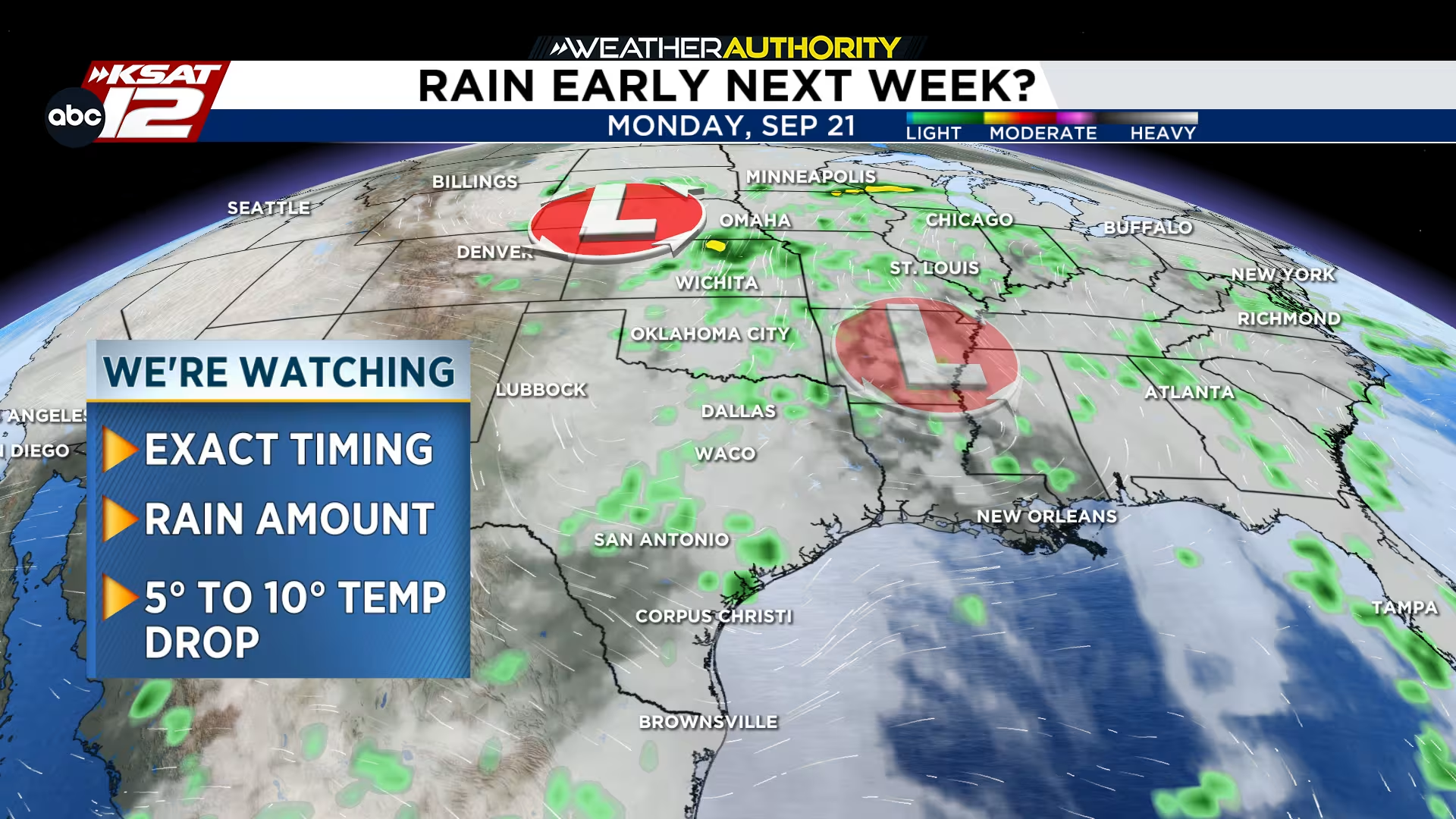
RAIN? COOLER WEATHER? FINALLY?!
By the weekend, we’ll start to see a major shift in the overall pattern. A trough will work its way across the country and could bring unsettled weather by Monday. This would also mean a small drop in temperatures. We’ll need to see a little more consistency in what the models are showing before latching on to this idea, but we are cautiously optimistic. Stay tuned!

KSAT meteorologists keep you on top of the ever-changing South Texas weather.
QUICK WEATHER LINKS
Copyright 2026 by KSAT – All rights reserved.
About the Authors
-
Shelby Ebertowski headshot 
Shelby Ebertowski
Shelby Ebertowski joined KSAT 12 News in January 2025. She came to San Antonio from Fargo, North Dakota via the University of North Dakota, where she learned the ropes as a weekend forecaster over two years at KVLY. Her love of weather love began after experiencing Hurricane Harvey in 2017.
-
Sarah Spivey headshot 
Sarah Spivey
Sarah Spivey is a San Antonio native who grew up watching KSAT. She has been a proud member of the KSAT Weather Authority Team since 2017.
Sarah is a Clark High School and Texas A&M University graduate. She previously worked at KTEN News.
When Sarah is not busy forecasting, she enjoys hanging out with her husband and cat, and playing music.