
The same slow-moving storm that brought rain to Southern California and severe weather and flash flooding to the deserts and Rockies this past week is still around and will finish on a cold and snowy note before winding down over the Plains this week.
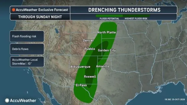
“The storm still has plenty of potency left through this weekend with additional pockets of heavy rain that can aggravate or lead to new flooding in parts of Colorado and New Mexico as well as raise the same concerns over parts of the adjacent central and southern Plains,” AccuWeather Meteorologist Brandon Buckingham said.
Some areas will be doused by a fresh 1-4 inches of rain from Saturday to Sunday evening. The AccuWeather Local StormMax™ rainfall is 10 inches.
Flash flooding could occur in just about any location where downpours linger or repeat through the weekend. The greatest danger will be in hilly terrain and desert locations, where a flood could occur in a matter of minutes. Mudslides are also a concern in steep terrain. Recent wildfire burn scar locations may be especially vulnerable.
As the storm continues to lumber along, just enough cold air will be available to bring a mixture of rain and wet snow over the higher elevations of the Rockies in Colorado and Wyoming.
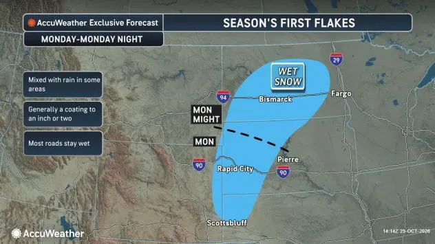
First snow of the season coming to the Black Hills, some lower-elevation areas in parts of the Plains
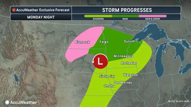
As colder air invades the storm as it travels from the Rockies to the Dakotas, eastern Montana and western Minnesota from Sunday night to Monday night, an area of heavier snow will develop outside of the highest elevations.
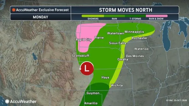
“There is the potential for several inches of snow to fall over the Black Hills of South Dakota,” AccuWeather Senior Meteorologist Bob Smerbeck said. “A slushy accumulation can occur in Rapid City, South Dakota, especially on non-paved surfaces on Monday, when it is most likely to snow the hardest.”
Some accumulating snow will also extend from eastern Wyoming and northwestern Nebraska to part of southwestern North Dakota.
The bulk of the storm’s rain and all of its snow is forecast to avoid the Denver metro area and the majority of the Colorado River basin. However, some runoff is entering the river and will help boost levels to some extent in the next couple of weeks.
Farther south, major to record flooding has occurred along portions of the San Juan River in northern New Mexico.
GET THE FREE ACCUWEATHER APP
Most areas from the Rockies to the Great Basin and the Plains remain in moderate to exceptional drought conditions.
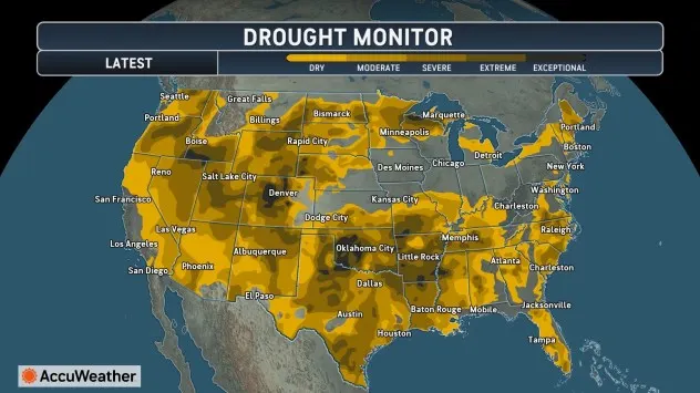
Only areas from eastern Colorado and northern Kansas to southeastern Nebraska and much of Iowa have received enough rain from summer to early Autumn to escape drought.
Storm to continue severe weather risk into Monday evening
The storm has had a history of producing severe weather since the start of the week. Most of the reports have been hail and damaging wind gusts.
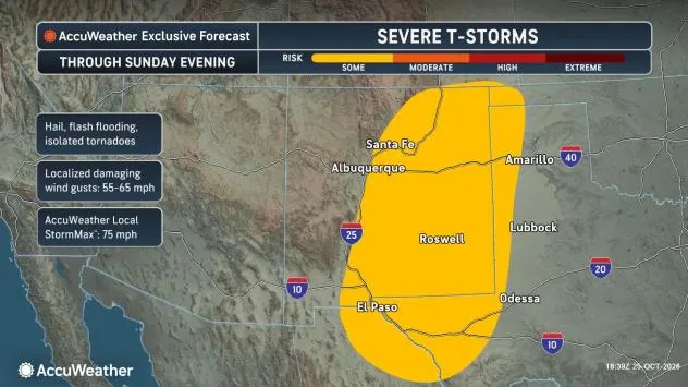
This will remain the main threat from the storm as we move into the new week. However, it is possible that a couple of brief tornadoes could be produced from the strongest storms.
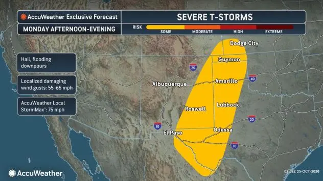
The main severe weather threat will focus on parts of New Mexico but expand to portions of West Texas into Monday.
Want next-level safety, ad-free? Unlock advanced, hyperlocal severe weather alerts when you subscribe to Premium+ on the AccuWeather app. AccuWeather Alerts™ are prompted by our expert meteorologists who monitor and analyze dangerous weather risks 24/7 to keep you and your family safer.