
HONOLULU (HawaiiNewsNow) – The threat for minor flooding and ponding will continue through tonight as a surface trough shifts over the eastern half of the state.
The trough axis has shifted eastward, bringing heavy rain and thunderstorms across Maui County and parts of Hawaii Island, including the Hamakua coast.
All schools on Molokai were closed Wednesday due to flooded roads.
Moderate to heavier showers with isolated thunderstorms will continue along that track through tonight, with lighter showers expected over the western end of the state focused over windward and mauka areas.
The rainfall totals have been beneficial overall with Molokai receiving the most rain and Kauai receiving the least. Heavy pockets have been reported over the mountains. The rainfall totals are under what the original weather models were projecting with some neighborhoods seeing drizzle rather than heavy rain. The upper-level jet and dynamics of this broad trough hasn’t been as significant as the earlier weather model runs that were originally predicting more thunderstorms. With this moist and somewhat unstable airmass, we have benefited from seeing fewer extreme downpours overall. Hawaii Island has seen a trace to about 3 inches of rain, but not everyone seeing the rain. The rain has been limited on Kauai.
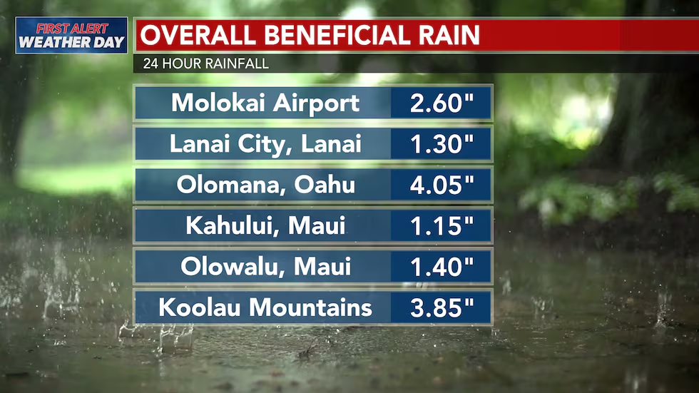
First Alert Weather Day continues into the night due to the potential for heavy rain that could lead to some flooding.
A Flood Watch remains in effect for Oahu, Molokai, Lanai, Maui, Kahoolawe and Hawaii Island through early Thursday as a trough brings “moist air” over the state from the south. Kauai is no longer under a watch.
The airmass overhead is holding double its usual moisture, creating a high capacity for producing heavier rain at times and a more humid airmass overhead overall.
Improvement expected Thursday or Friday
Conditions are expected to improve Thursday or Friday, with trade winds returning this weekend, though spotty heavy showers could linger.
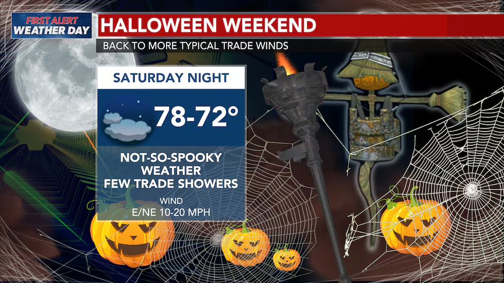
A brief period of trade winds is expected to return Friday night into Saturday, with breezy northeast winds developing Sunday as a shallow front moves near or over the state.
Weather for Halloween trick or treating could be a little wet, but mainly for windward and mauka neighborhoods.
Your First Alert Weather Team will closely monitor conditions and First Alert you to any changes.
Copyright 2026 Hawaii News Now. All rights reserved.