
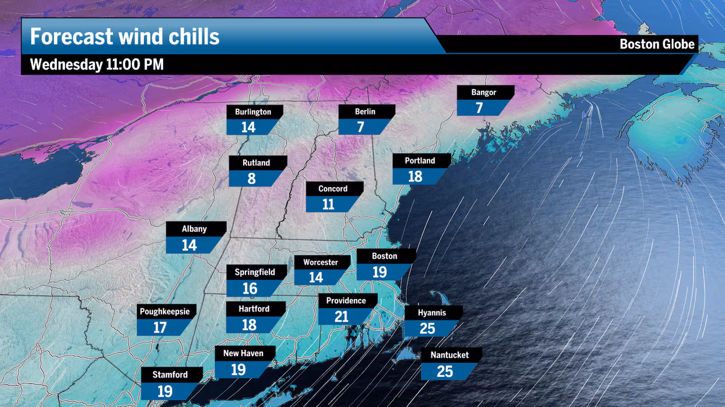
Wind advisories were still posted Tuesday evening after a very blustery day. There were some localized power outages and tree damage, but for the most part, this was just an annoying and cold day before New Year’s Eve.
We have some snow in the forecast for Wednesday, New Year’s Eve, and the heaviest will fall in an unlikely area when you think about who typically gets the most snowfall. That’s right, it looks like Nantucket and Martha’s Vineyard are going to receive up to 4 inches of snow overnight New Year’s Eve, as a potent area of energy moves through the region on a fast jet stream.
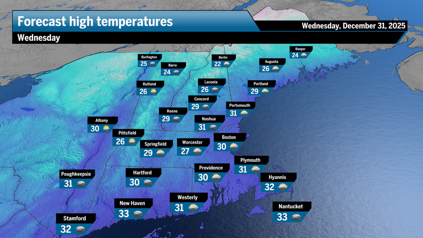
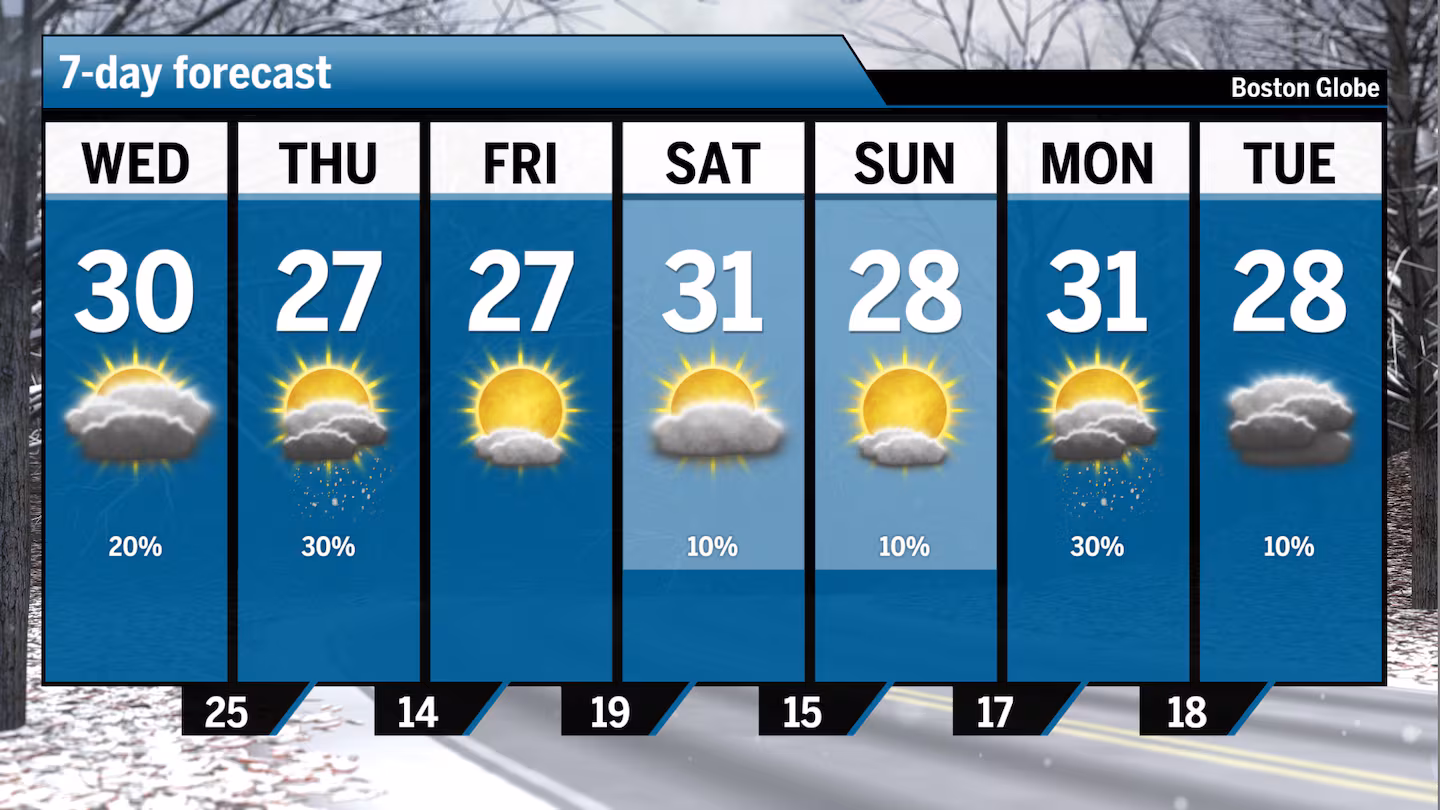
The day will start out partly sunny with highs around 30 before dropping into the 20s around dinnertime.
Then the snow will overspread the region from the west and south, starting at 10 p.m. The last places to see snow will be Essex County and Southeastern Massachusetts. Some light snow arrives after midnight in the Boston area. However, Nantucket and Martha’s Vineyard are likely to see some light snow beginning before the ball drops at midnight.
Who will see the heaviest snow?
The snow will become enhanced and could come down quite hard over the islands in the pre-dawn hours of New Year’s Day. It’s possible that the steadier snow even makes it up to southern Bristol and Plymouth counties in Mass.
For the Cape itself, look for 1 to 3 inches of snow with the highest amounts on the Mid and Outer Cape.
Travel will be impacted after midnight, so if you’re headed to a party and then heading home in this area, be aware that roads are likely to be snow-covered, especially the later you travel. Certainly, by New Year’s morning, much of Cape Cod and the islands will have snow-covered roads.
Boston area: A coating to an inch of snow
To the north, the rest of us will see a coating to perhaps an inch at most. Any early snow on New Year’s Day will be ending and then it becomes partly sunny and a little bit blustery with temperatures in the 20s to lower 30s north to south.
Friday is sunny with temperatures still in the mid- to upper 20s away from the coastline and within a few degrees of 30 south of Boston.
New Year’s Eve breakdown
Greater Boston: Look for partly sunny skies on Wednesday with the temperature near 30. Some light snow arrives after midnight New Year’s Eve. Any snow ends on New Year’s Day with clearing.
Southeastern Mass.: Look for partly sunny skies for Wednesday. Snow arrives after midnight Wednesday night and ends Thursday.
Cape and Islands: Look for partly sunny skies for Wednesday with highs in the lower 30s. Snow arrives near midnight New Year’s Eve and accumulates up to 4 inches over the islands by mid-morning New Year’s Day.
Rhode Island: Look for partly sunny skies on Wednesday with highs near 30. Some snow arrives, especially over the South Coast Wednesday night after midnight.
New Hampshire: Look for cloudy skies to develop on Wednesday with highs near 30. A few snow showers in the pre-dawn hours of New Year’s Day will end with temperatures in the 20s on Thursday.
Vermont/Maine: New Year’s Eve will see mostly cloudy skies with snow showers late. Highs reach the mid-20s. The new year begins with some sunshine and clouds, with highs held to the teens across both states.
Sign up here for our daily Globe Weather Forecast, which will arrive straight into your inbox bright and early each weekday morning.