
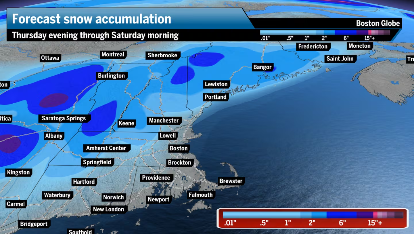
• Snow — This storm holds a decent shot of delivering a coating to a couple of inches of snow along Route 2, west of I-495, and a coating to 3 inches of wet snow in a few higher-elevation spots across the Berkshires, northern Worcester County, and most of Vermont, New Hampshire, and Maine, with isolated spots seeing 3 to 6 inches across the highest terrain.
• Rain — For the lower elevations and by the coast, it just won’t be that cold for widespread snow. Greater Boston should end up with about a half inch of cold, windswept rain, a lot less than what we experienced last week. The same rain scenario plays out as you head south to Cape Cod, the South Coast, and Rhode Island.
East of I-495 and south of the Mass Pike should all stick to light and steady rain. There is a chance for a few snowflakes mixing in at low elevations at times, especially overnight-early Friday, but the odds of anything sticking, like along I-95 and I-495, are close to zero.
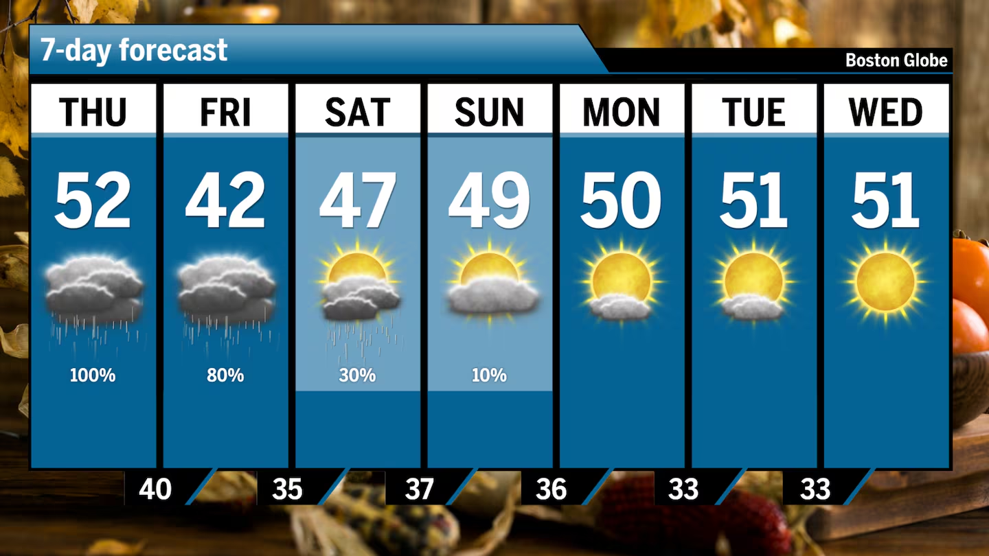
Light snow and rain start moving into Western Massachusetts, Connecticut, and parts of western Vermont late Thursday morning. Rain will extend into Greater Boston, Southeastern Mass., Cape Cod, and Rhode Island in the afternoon — about an hour before or after the evening commute — and last into the night.
Scattered pockets of precipitation will continue overnight and all day on Friday. Cold rain showers will continue across Greater Boston and most of Southern New England, turning into steady rain. Northern New England and the higher elevations across Massachusetts will see a wintry mix as Thursday night arrives and temperatures fall — eventually changing over to all snow overnight into Friday.
The storm winds down Friday night, and a light spot snow shower or rain will linger across the region before tapering off Saturday morning.
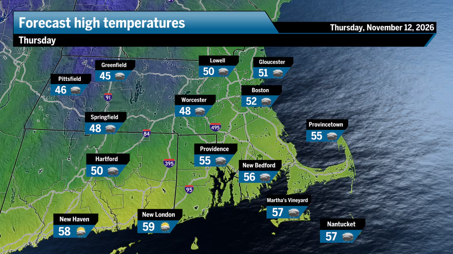
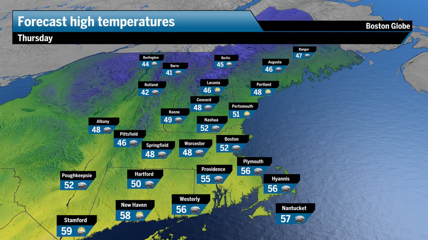
Thursday will see temperatures slowly climb into the upper 40s and low 50s across most of Southern New England under mostly cloudy skies.
Blustery and turning colder on Friday
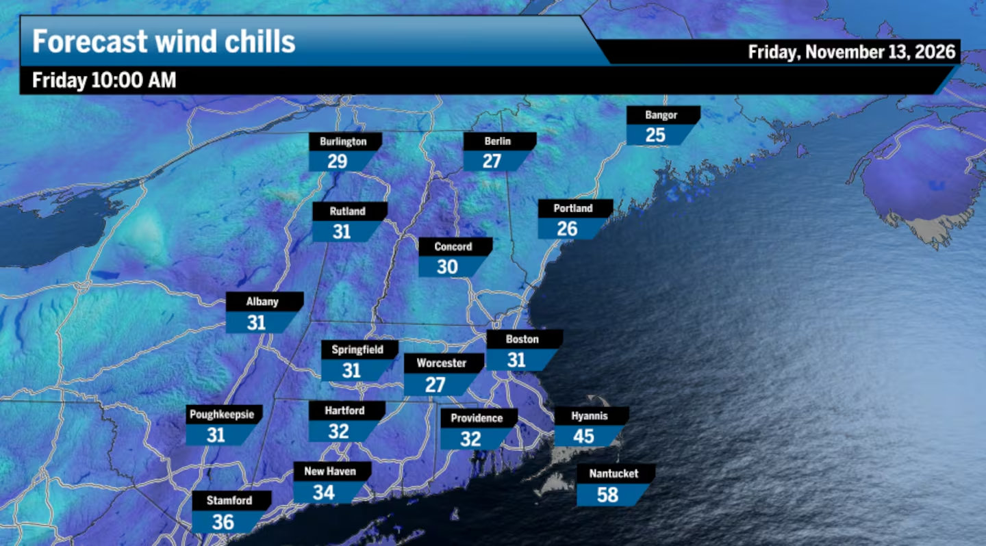
Now we can’t have a storm-turned-nor’easter without wind, right? We’ll see gusty conditions beginning Thursday afternoon and lasting through much of Friday, but even with the storm slated to intensify once reaching the ocean, we should see wind gusts top out at 20 and 30 mph along the coast.
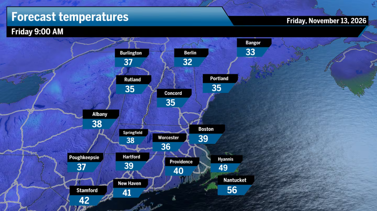
With New England on the western side of the storm on Friday, you’ll feel the cold air funneling south while snow continues up north. Friday morning is the best chance for snowflakes to mix with the rain as far south as the Mass Pike and the I-495 to I-95 belt. There’s another chance for a few morning flakes on Saturday, but I don’t expect any accumulation as the snow shouldn’t stick to the ground.
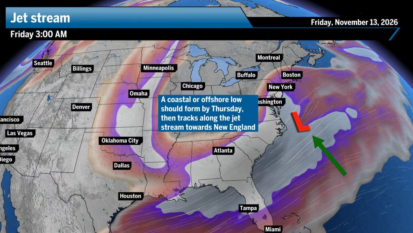
Storms often develop on the eastern side of a U-shaped dip, or trough, in the jet stream. That’s because winds aloft in that area are fastest and spreading apart, creating what we call upper-level divergence. As air spreads out high in the atmosphere, that triggers air near the surface to rapidly rise to fill the void, creating an area of low pressure. Those fast winds also allow the low to intensify while following along the jet stream “highway.”
This week’s system will tap into the strong jet stream winds and intensify just south of New England on Friday.
It’ll be interesting to see how much snow does actually accumulate, with wet snowflakes and ground melting coming into play. Snow totals just might wind up slightly below what is forecast.
As far as Boston rain, keep in mind that the city usually sees its first inch of snow around Dec. 11, and I suspect we’ll still be waiting for that 1 inch of snowfall after this storm passes.
Greater Boston: Mostly cloudy. Showers enter Thursday afternoon and linger through the night, turning into steady rain. Highs in the low 50s.
Central and Western Mass.: Mostly cloudy to overcast. Showers enter the region during the morning and last through the rest of the day. Some wet snowflakes develop during the afternoon across the Berkshires to Northern Worcester County. Highs in the low 40s in the Berkshires, upper 40s east.
Southeastern Mass.: Mostly cloudy with highs in the mid-50s. Showers enter during the afternoon and last into the night.
Cape Cod and Islands: Mostly cloudy with highs in the mid-50s. Showers enter during the afternoon and last into the night.
Rhode Island: Mostly cloudy to overcast. Scattered showers begin by the early afternoon. Highs in the mid-50s.
New Hampshire: Mostly cloudy to overcast. Highs stall in the mid-40s. Showers enter the region late morning and last through the night, switching over to wet snow.
Vermont/Maine: Mostly cloudy, turning overcast early. Showers enter Vermont by mid-morning, Maine later in the afternoon. Turning to snow during the evening and night. Highs in the mid-40s.
Connecticut: Mostly cloudy to overcast with showers entering the state from the west by mid-morning. Highs reach the low to mid-50s.
Sign up here for our daily Globe Weather Forecast that will arrive straight into your inbox bright and early each weekday morning.
Ken Mahan can be reached at ken.mahan@globe.com. Follow him on Instagram @kenmahantheweatherman.