Severe storms may bring hail, gusty winds, frequent lightning, tornado risks and heavy rain to parts of Indiana before colder air arrives.
INDIANAPOLIS —
Weather Impact Alert: Tuesday night into Wednesday morning
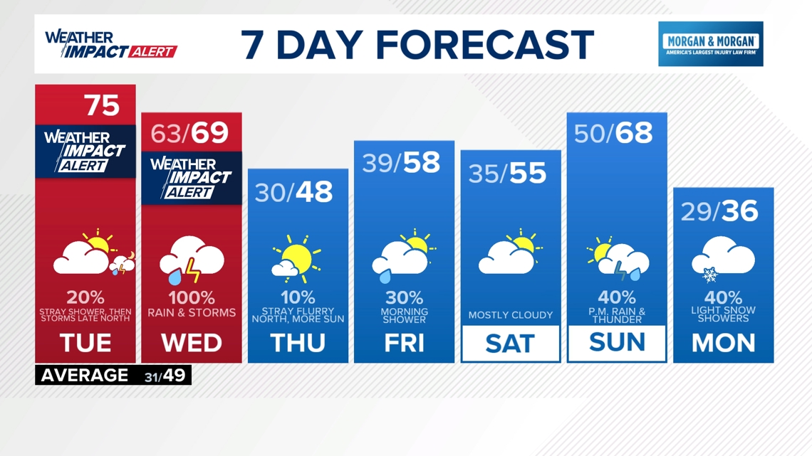
After a possibly record warm day, active weather with severe storms move into Indiana Tuesday night and Wednesday. The severe risk is considered low to medium overall, but a few storms could still become very strong at times with a chance for a tornado, gusty winds and hail.
Tap HERE to track the rain and storms with our interactive radar.
Instead of one big line of storms, we expect multiple storm clusters. Our setup favors two main waves of thunderstorms, each with different threats and timing, depending on where you live in the state.
Severe zones next 36 hours
The first round of storms will mainly target northern and north-central Indiana, where the atmosphere will be slightly more favorable for stronger storms Tuesday night. Supercells are likely to the north.
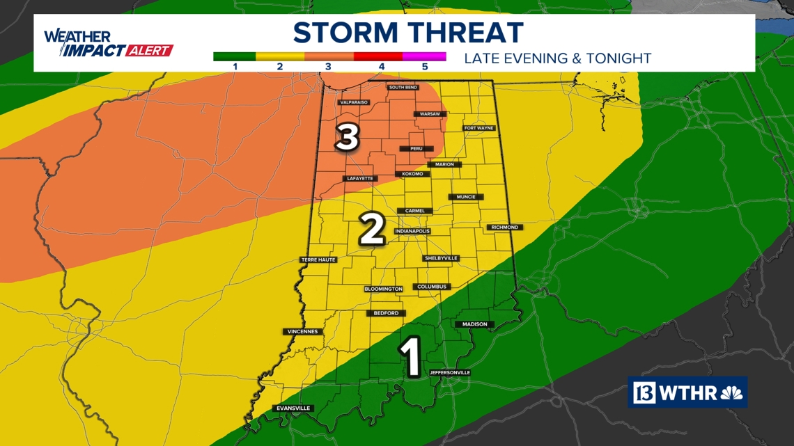
Areas of northwest Indiana may see the highest severe potential in the state.
The second round will shift the focus farther south into central and southern Indiana during the Wednesday early morning hours.
Even though the severe risk continues during the second wave, storms may weaken somewhat as they move into the morning hours.
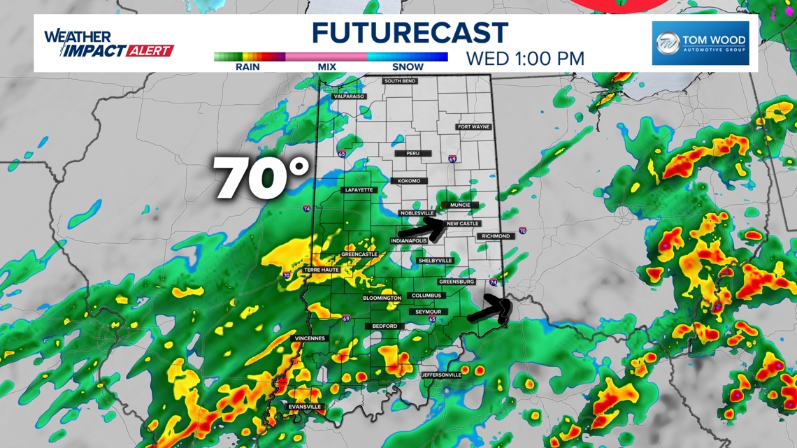
By Wednesday afternoon, severe threats will mainly push out of Indiana, but we’ll keep a close eye on far eastern and far southern Indiana.

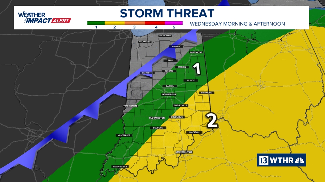
There will be multiple rounds of rain and storms, but we do think northern Indiana has the highest chance late Tuesday and into the overnight hours. Central Indiana’s highest severe chance will be Wednesday morning.

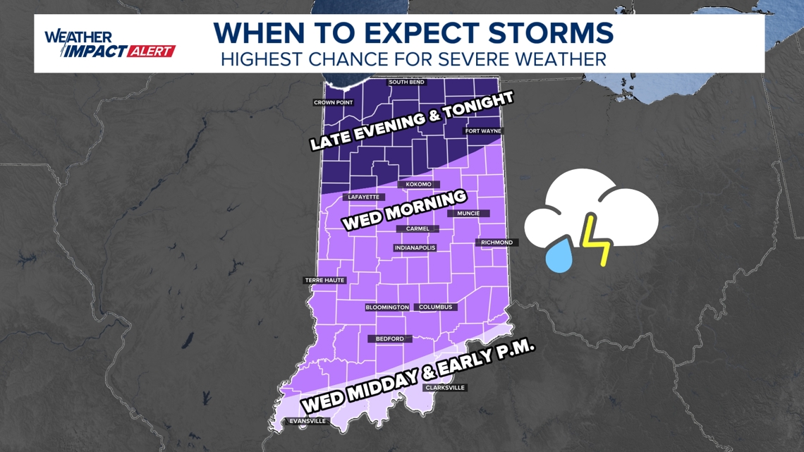
- Dark purple: late Tuesday evening and tonight
- Purple: early-mid Wednesday morning
- Light purple: Wednesday midday to afternoon
Wave 1: Tuesday evening to early Wednesday morning
7 p.m. Tuesday – 4 a.m. Wednesday
The first wave of storms will move across the northern half of Indiana, with the greatest concentration of severe storms possible in northwest Indiana.

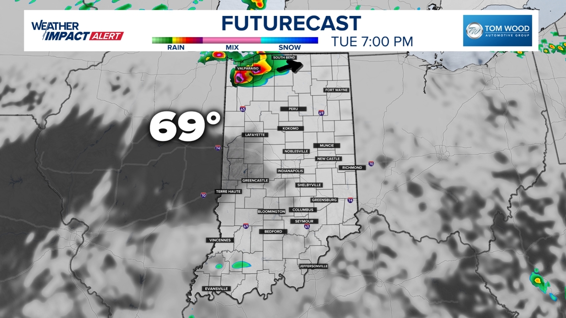
Storms will likely move in clusters rather than a single organized line. These could spin more easily. There may even be individual supercells at times with a tornado risk.
Slowly, storm threats will spread south through the night.

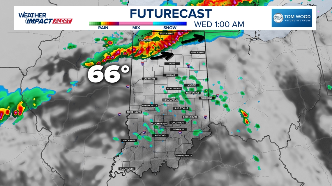
Wave 2: Early Wednesday morning
4 a.m. – Noon Wednesday
The second wave shifts southward into central and southern Indiana, including the Indianapolis metro area.

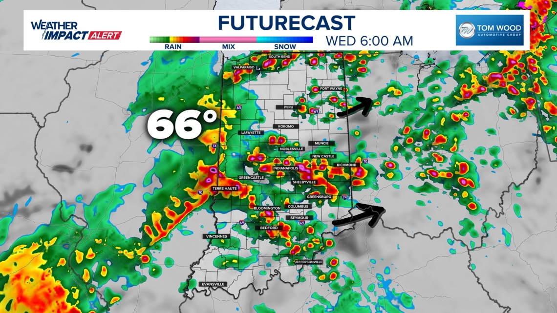
This round could bring additional thunderstorms during the morning commute, though storms may be a little weaker than the overnight activity to the north.
Even after the main severe windows pass, scattered rain showers and occasional thunder may linger across the state for several hours Wednesday afternoon.

Tornado risk
The highest tornado risk will occur during the first wave Tuesday night, particularly across northwest and north-central Indiana.

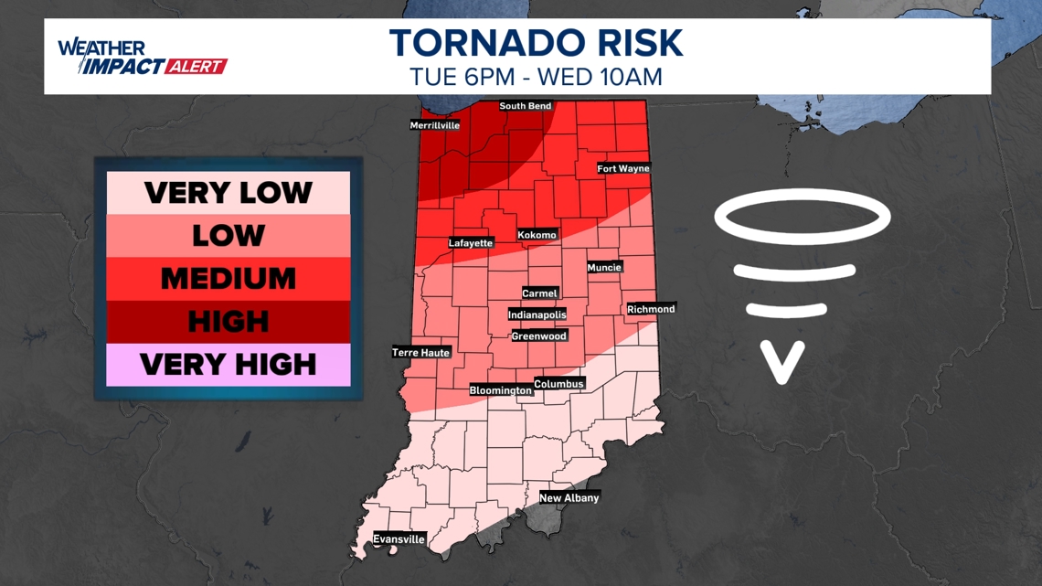
Any tornado threat appears isolated, but conditions could briefly support rotating storms. Tornadoes in northwest Indiana could reach EF-2+ strength. Tornado risks are lower in central Indiana, but not zero.
Large hail
Hail will also be most likely during the Tuesday night storms, especially across northern Indiana.

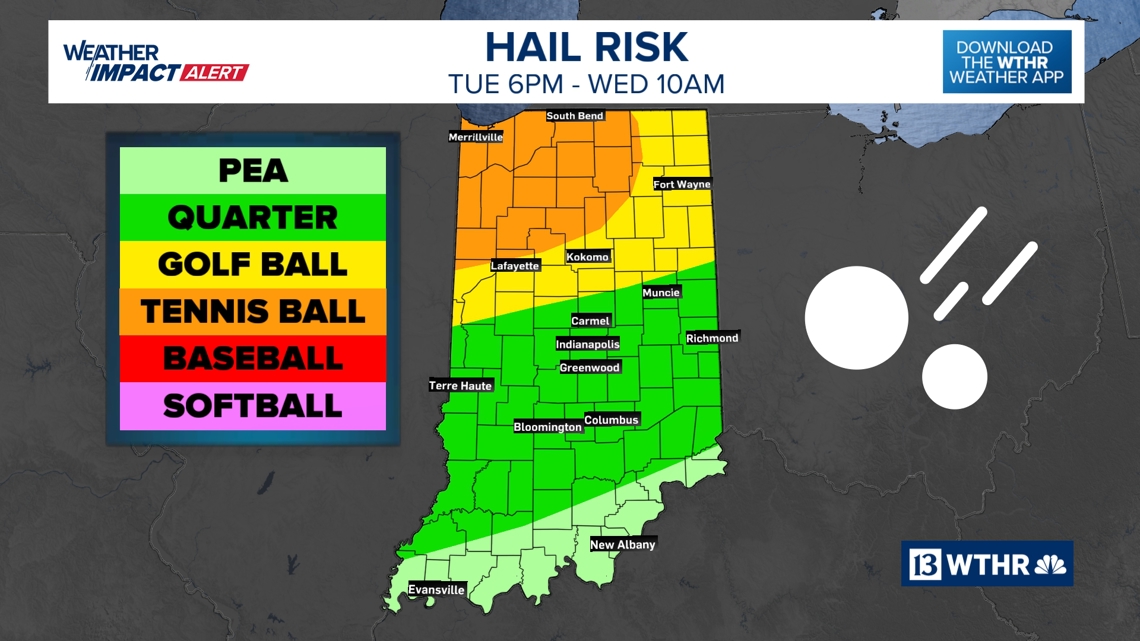
Some stronger cells could produce hail up to tennis ball size, mainly in northwest Indiana. Quarter sized hail would be more likely in central Indiana.
Damaging wind
The best chance for gusty or damaging winds may come with the Wednesday morning storms across central and southern Indiana.


Storm clusters moving through the region could produce bursts of strong winds along with frequent lightning.
Along with the severe weather threat, storms will bring a healthy amount of rain to the state.
Expected totals range from:

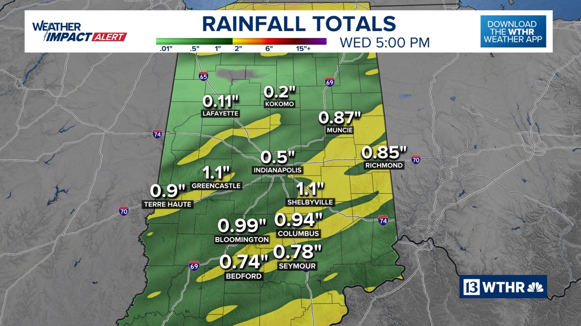
Localized higher amounts are possible where storm clusters repeatedly move over the same areas.
After storms move out Wednesday, the weather will change quickly.
A surge of colder air will push into Indiana Wednesday evening. By Thursday morning, skies should clear, but temperatures will feel much different compared to the warm start of the week.

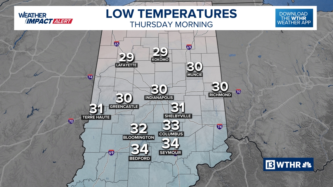
It will be quite the contrast after the mild spring-like weather earlier in the week.
Indiana will experience two rounds of storms from Tuesday night into Wednesday, with the greatest severe risk across northern Indiana Tuesday night and central to southern Indiana Wednesday morning.
While widespread severe weather is not expected, isolated tornadoes, large hail and damaging winds will all be possible at times.
Stay weather aware overnight and into Wednesday morning as storms move through the state.
-13News Meteorologist Matt Standridge