
COLUMBIA, S.C. (WIS) – A First Alert Weather Day is in effect as a cold front brings us a line of rain and thunder this morning.
First Alert Headlines
- First Alert Weather Day in effect for strong storms possible this morning.
- Chilly temperatures return Friday morning.
- Nice start to our weekend with rain chances returning Sunday.
First Alert Summary
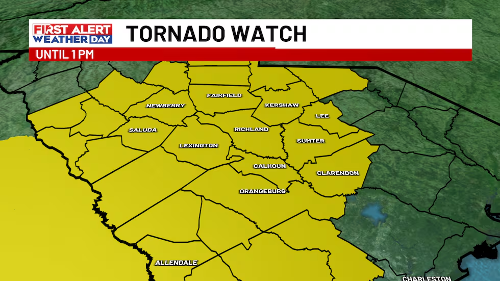
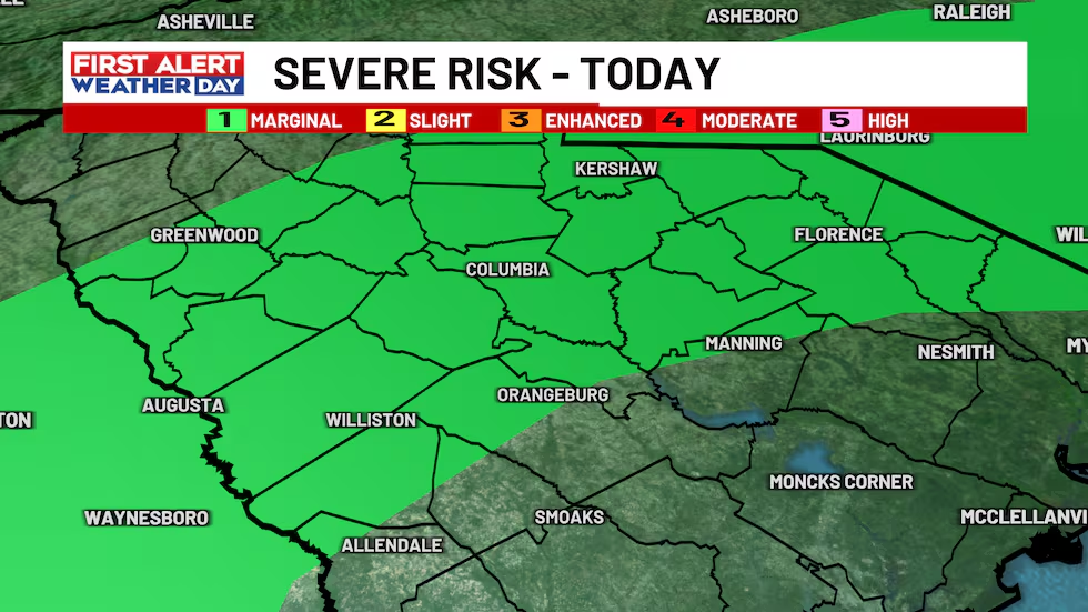
Good morning! A Tornado Watch has been issued by the Storm Prediction Center until 1 PM. A brief tornado or two are possible as this line of showers and storms move through.
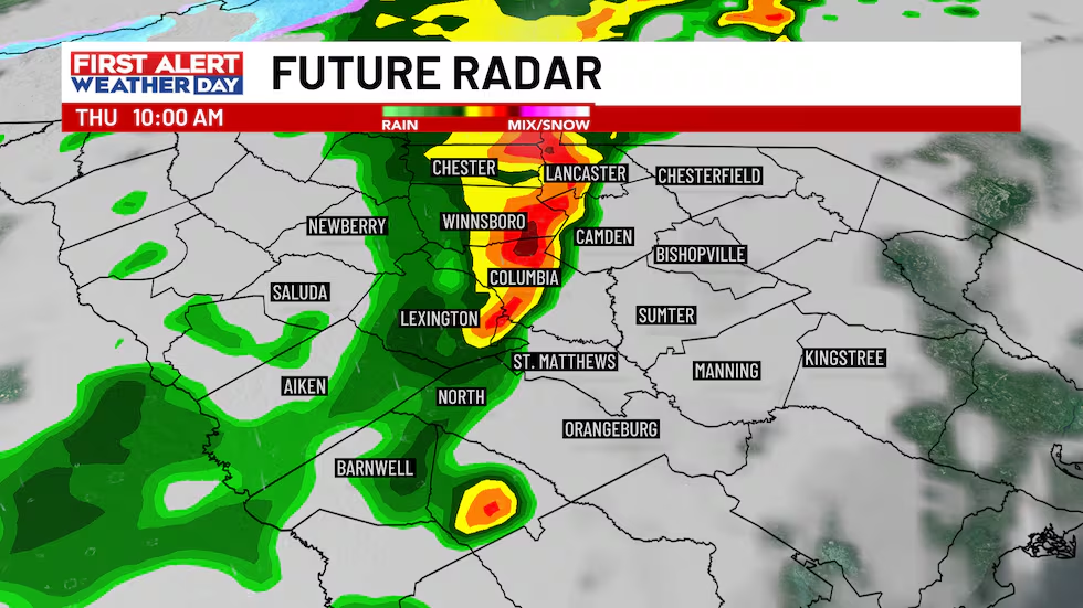
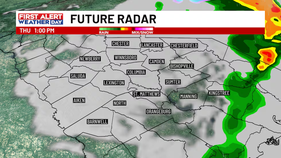
A strong cold front arrives from our west this morning, bringing with it a line of rain, thunder and gusty winds. There’s a low chance that a storm or two within this line becomes strong or severe, which is why we issued a First Alert Weather Day.
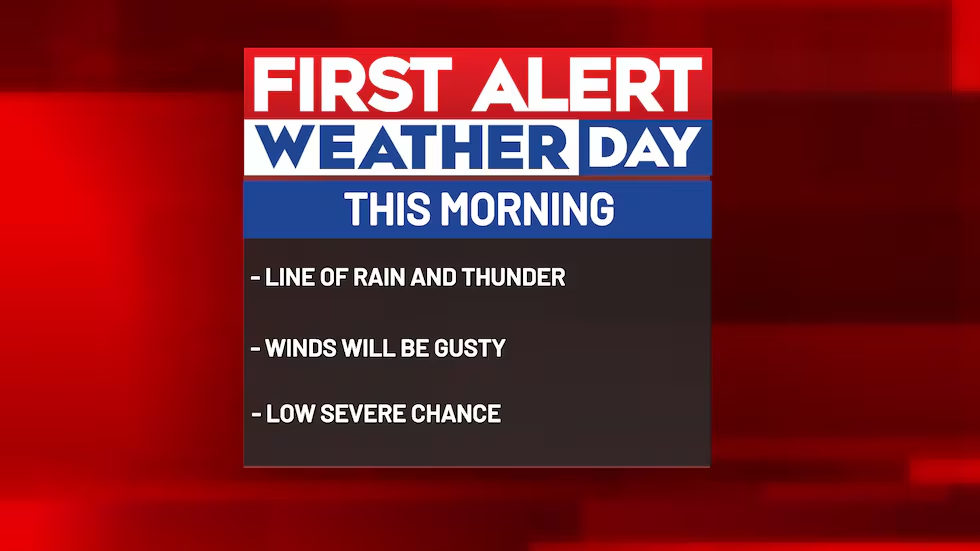
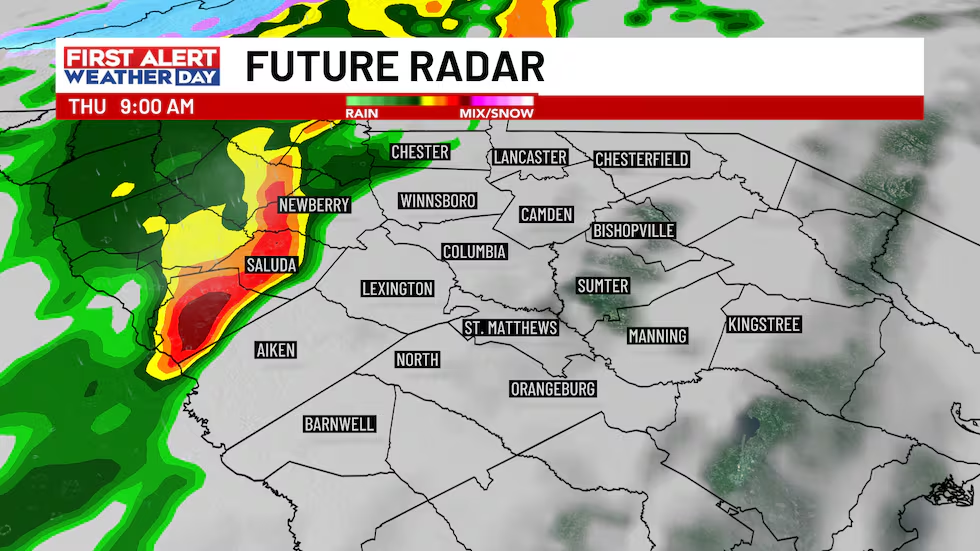
By 10 and 11 AM, this line will be moving across the heart of the Midlands, bringing with it gusty winds, rain and thunder.
Into the early afternoon, this cold front moves offshore, taking showers and storms with it.
As mentioned above, there’s a low chance that a storm or two will become strong or severe. The primary threat with a strong to severe storm would be gusty winds. Our tornado chance isn’t zero, but it’s low. Because of this, the Midlands are under a Level 1 Marginal risk from the Storm Prediction Center.
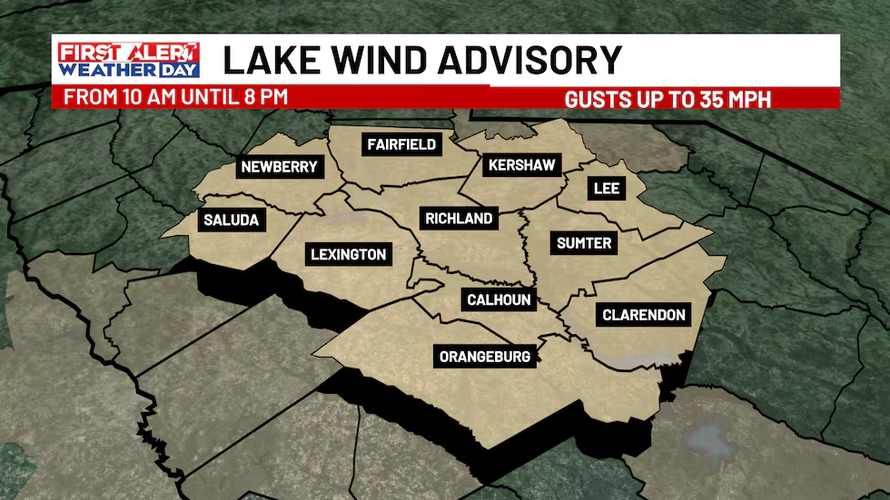
Later this morning and continuing into the afternoon, winds will pick up as this cold front passes through. Even after the rain ends, we’ll stay breezy. A Lake Wind Advisory goes into effect at 10 AM and lasts until 8 PM.
Behind this cold front, temperatures will drop quickly, with a chilly morning on tap for Friday. Friday afternoon will be cooler, but it’ll still feel nice with plenty of sunshine and highs in the mid and upper-60s.
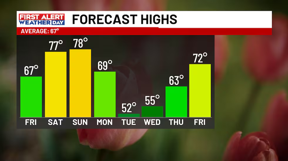
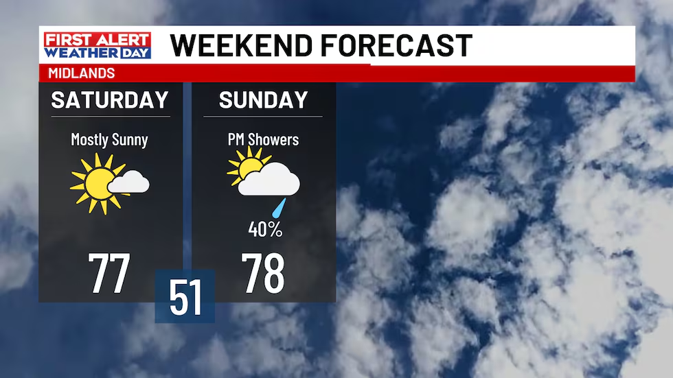
Nice weather continues Saturday! We’ll have lots of sunshine and highs in the 70s. Sunday, another cold front approaches from our west, giving us another chance of rain for the end of the upcoming weekend.
First Alert Forecast:
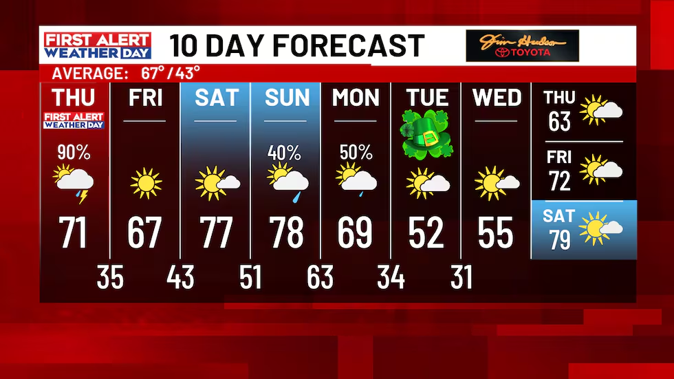
FIRST ALERT Weather Day (Today): Cloudy with showers and storms through Midday. Storms may contain strong gusty winds. Chance of rain 90%. Then, becoming partly cloudy. Highs around 70 degrees.
Tonight: A clear sky. Lows in the mid-30s.
Friday: Lots of sunshine. Highs in the mid and upper-60s.
Saturday: Mostly sunny. Highs in the mid and upper-70s.
Sunday: Increasing clouds with scattered showers returning in the afternoon and evening. Chance of rain 40%. Highs in the upper-70s.
Monday: Cloudy with scattered showers through the early-afternoon. Chance of rain 50%. Highs in the upper-60s.
Tuesday: Partly cloudy. Highs in the low-50s.
Feel more informed, prepared, and connected with WIS. For more free content like this, subscribe to our email newsletter, and download our apps. Have feedback that can help us improve? Click here.
Copyright 2026 WIS. All rights reserved.