
TAMPA, Fla. — There has been a lot of buzz online about the possibility of gulf-effect snow in Florida for late Saturday into Sunday morning. While there is a small chance of this happening, it will certainly be tough to produce.
What setup is even making gulf-effect snow possible at all? Well, just like lake-effect snow, there will be much colder air over relatively warm water. This creates instability. Add in some wind, in our case a N/NW wind at 20 mph to 30 mph, and you get increased evaporation.
A cold front will bring in colder air.
This moist air from the gulf rises into much colder air aloft. Since colder air can’t hold as much moisture, it falls as precipitation (snow if it’s cold enough).
In this particular case, the air may be too dry for precipitation to make it to the ground. In the most ideal situation for gulf-effect snow this weekend, some isolated snow flurries are possible early Sunday morning before sunrise. If they happen, it likely won’t last long.
There are a few things acting against the possibility of snow flurries this weekend.
First, temperatures will only be marginally cold enough in the area, with the Nature Coast seeing the best chance of cold lining up with enough moisture.
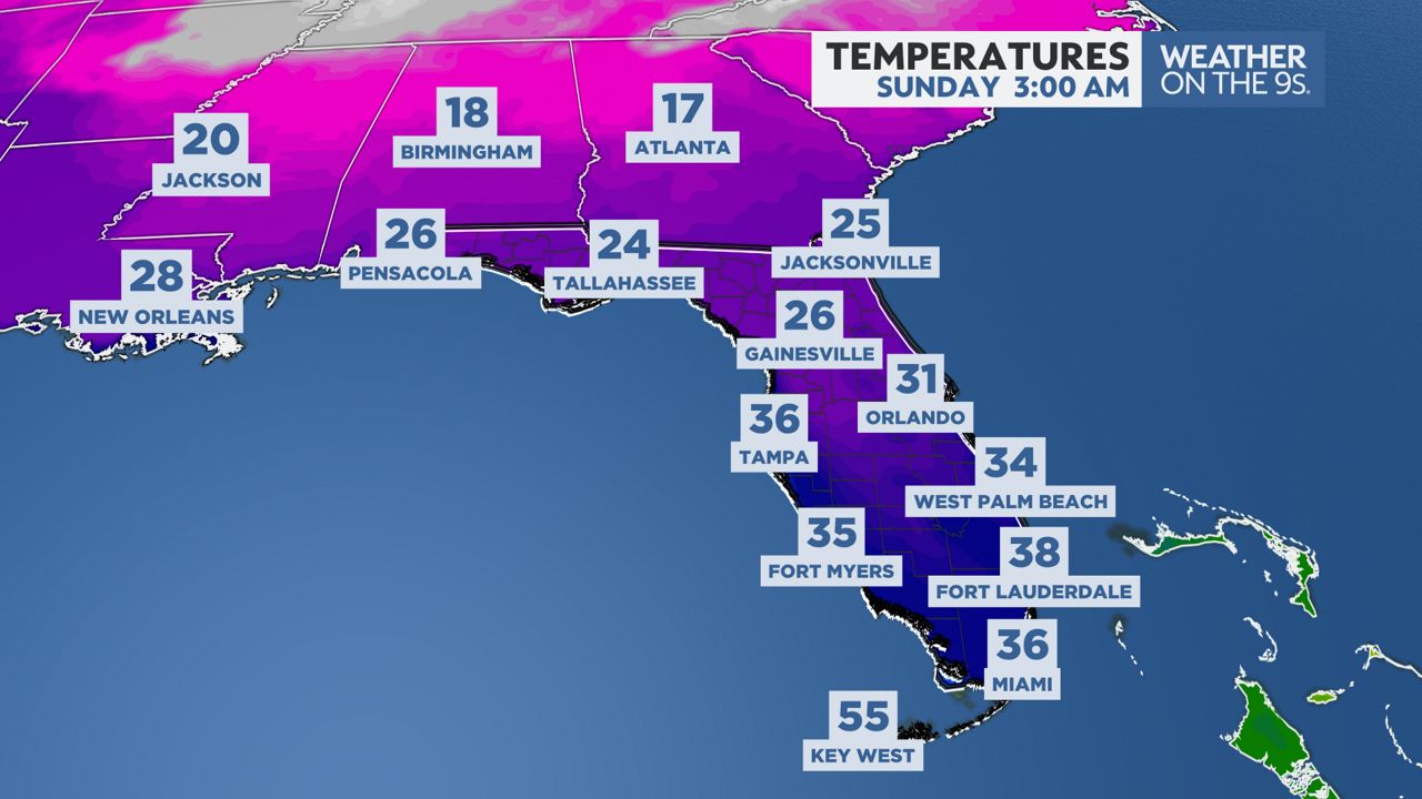
European model showing forecasted temperatures on Sunday at 3 a.m.
That brings us to the second problem: dry air. When temperatures start to drop Saturday night, so will the moisture.
The upper atmosphere will be totally dry, but there may be just enough moisture near the surface to produce very light precipitation.
By daybreak Sunday, when temperatures are at their coldest, moisture will be more limited compared to overnight.
The third problem will be wind direction. Some models keep a northwest wind into early Sunday, while others flip to a north wind quickly.
In order to produce gulf effect snow, we would need the wind to stay out of the northwest to bring in gulf moisture. A north wind would get us colder, but we would stay dry.
Our team of meteorologists dives deep into the science of weather and breaks down timely weather data and information. To view more weather and climate stories, check out our weather blogs section.